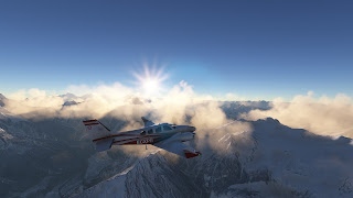
The aim of this leg was to take 5 passengers around the Sisha Pangma, at the North of Kathmandu, and land at Lukla. However, I ended up landing at Bohjpur. Let's begin by the takeoff, between clouds, on visual, fighting against the clouds, rain and terrain.
From Kathmandu I head north, looking for the valley west of Langtank National Park. However, the clouds and snow make the orientation a bit tricky. Also, I counted on the silhouette of Shisha Pangma to orient myself but it's a bit "flat" to be recognized from the south. I ended up crossing to China and orienting myself once I saw Peikucuo Lake, at 16,000 ft. I fly at FL235, over the critical altitude.
I thought I was flying more to the east. And it was at this moment, I knew I've screwed things up. The sunset was again faster than I usually expect, and I was a bit far from where I should, so most likely it would be at night by the time I return to Nepal. I decided to fly east over China, and think about what to do after the Shisha Pagnma.
And there it is, the Shisha Pangma, the lowest eight-thousander with 8,027 m. Really beautiful from China. It even looks easy to climb from there, although it has been one of the most difficults due to its location, far from any civilization.
Now I begin to descend while thinking about 2 options. Landing at Lukla is risky, even more at night, so the original destination is quickly discarded. There are two strips south of Lukla that could be suitable for landing, but one is too short. The second, at Bohjpur, is at the landing limit distance of the Baron, along a crest of a hill, as I can deduce from the map. I guess that if the landing goes wrong, I can easily do a go around since all the terrain around is lower than the runway. In addition, since it's on a hill, there's a lower risk of terrain issues during approach maneuvers at night. And there's also an NDB nearby, that I could use to orient myself. Just in case, I decide to get the charts of Kathmandu, since a return to the origin will be my plan B if I cannot land at Bohjpur.
It gets dark very fast. I follow the NDB and I doubt I'll see the airfield. I decided that I will give only one try. If I don't find it, I'll go directly to Kathmandu. But at the very last minute, I manage to see the runway and I do a pattern to descend, following the terrain. As I expected, in case of missed approach it will be easy to escape, since the airfield is pretty high, although there is a tall wall on a side. But the approach was perfect and the touchdown couldn't have been better.
My passengers are a bit scared, but they wanted adventure, right? Tomorrow, a short flight to Lukla, one of the most dangerous airports in the world.
------
NAUBI LANGTANG SHISHAPANGMA RIQIANG ZHANGMU PHAPLU
VNKT 261200Z 29004KT 250V320 8000 FEW010 SCT030 BKN250 24/20 Q1009 NOSIG
N/A


No comments:
Post a Comment