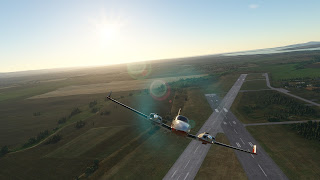
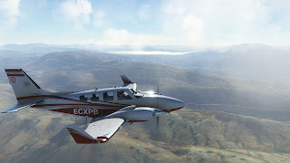
These days it has been rainy and stormy over Turkey, so I have delayed a bit this leg. But finally, a window of good weather was available, so I loaded the 430 kg of cargo I had to transport and taxied to the runway. I didn't detect any problem during the startup. However, as I began the run for takeoff, I noticed that the airspeed indicator was not working. I manage to abort before the Vr and slow down till the end of the runway. Time to visit the workshop. Luckily, it was just an obturation of the pitot, so easy to fix and very cheap.
With some time lost, I takeoff again, this time without any problem, and I enjoy the sunrise over the Black Sea, on my way towards Turkey.
I'm concerned about the clouds I see at the horizon. As I approach to Istambul airport I check the ATIS, and there are really low clouds around the area. For some time I doubt if going over the clouds, expecting to see the ground through open areas to orient myself, or descend next to ground and try to fly under the clouds. I decide the second, although I'm ready to climb, cross the clouds and enter IFR for some miles if needed. This was not in my plans. That delay at the workshop was not good.
By the time I arrive to the Bosphorus, the sky is much more open, so I take advantage to get a bit of altitud, but not much, since I prefer to fly low along the strait and to see Istambul from close.
From here, I climb over the Mediterranean and begin to fly over Asia. Crossing Turkey from North to South was a great experience, not only because of the landscape, with both fields and mountains, but also because of the clouds, that I had to surround several times to avoid ice formation.
The visual approach to Antalya was tricky, since the terrain is hard to follow and the visual charts did not inform about the adequate altitude. But I managed to fly over the huge city of Antalya, fifth in population but considered the capital of tourism, and land in its huge airport.
Now I have several options to continue towards the Himalaya. But, so far, we have landed in Asia, after the longest leg until now. Europe is done.
------
SREDETS SOZOPOL COAST BKZ IZNIK-GOLU KUTAHYA BURDUR-GOLU UGURLU BAYATBADEMLER NEBILER MARINA
LBBG 302030Z AUTO 26004KT 9999 NSC 18/16 Q1016 NOSIG
LTAI 302250Z VRB03KT 9999 BKN030 18/18 Q1014 NOSIG RMK RWY18C 34002KT RWY36R 36004KT RWY18L 02003KT


No comments:
Post a Comment