Thursday, April 30, 2020

World Tour Leg 24 - Yanbu to Madinah

Yanbu has been known at least for the last 2.500 years, as the starting point of the spice and incense route between towards the Mediterranean region. Nowadays, its population works mainly in the oil industry and refineries, although tourism is increasing due to its beaches and scuba-diving activity. And thanks to that, I found 5 PAX that wanted to travel to Madinah, going on with their personal tour around Saudi Arabia. So I accepted to carry them in this leg, since Madinah sounded like an interesting destination. It would be a direct flight, without landmarks, of barely 100 nm.

It was quite windy, with winds of 16 kt from 270. Luckily, the runway orientation was 280, so no much crosswind. I decided to climb fast, to avoid potential turbulences next to the ground.


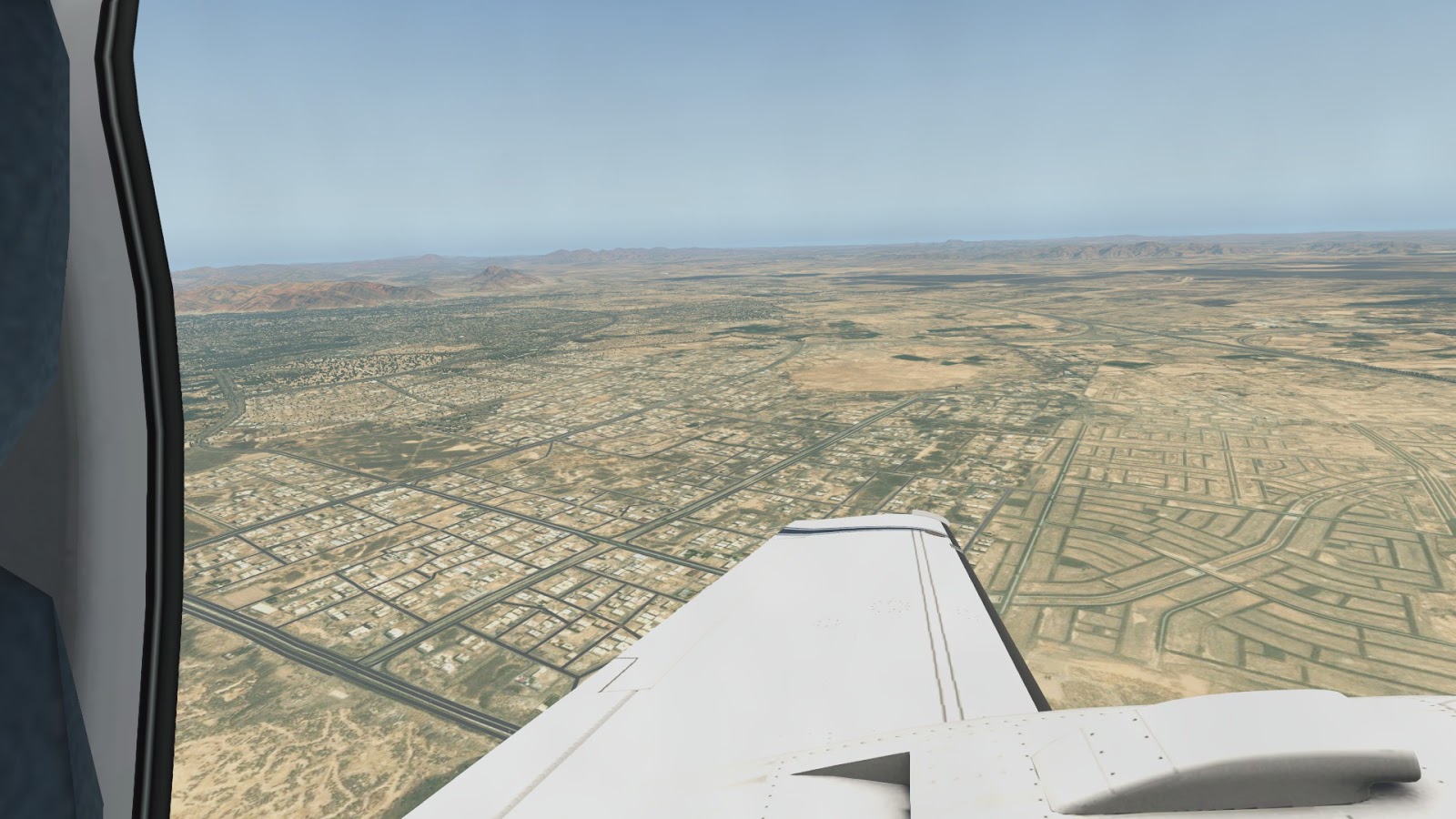
Once in the air, I took a right pattern while I was climbing. The landscape was quite interesting as I gained altitude, since I could see the contrast between the coast, the city, the sandy plains and small mountains showing up in the horizon.


I quickly tuned Madinah VOR. It worked, so the technician at the FOB did a great job. I climbed until 7.500 ft., minimum safe altitude for the area. But, as I was approaching the mountains, I realised I was going to fly maybe too low. Considering the strong crosswind I had at that time, I decided to climb to 9.500 ft., just for safety.


And, after an interesting chain of mountains, I could see Madinah. Located on a plain between mountains. This large city, whose core is forbidden to non-muslims, is the burial of Muhammad and contains the Prophetic Mosque, second holiest site in Islam after the Great Mosque in Mecca. Actually, Madinah is an important pilgrimage destination, since together with Mecca and Jerusalem completes the three holiest cities in Islam.


Winds were more calm here, just 5 kt. I decided to land on runway 36, the shortests of both runways at Madinah airport. I made a long pattern to descend from 9.500 to about 4.000 ft. The final was quite nice, with the views of the city and nearby hills. Another landing to remember.


------

Technical details:

OEYN - OEMA

DCT

Distance: 100 nm
Average GS: 200 kt
Average alt.: 9500 ft.

METAR:
OEYN 292200Z 27016KT CAVOK 25/17 Q1006 NOSIG
OEMA 292300Z 21005KT CAVOK 26/04 Q1011 NOSIG


Tuesday, April 28, 2020

World Tour - North Africa summary

Well, it looks like the challenge is moving on. The following map contains the legs (not the actual routes, just arrivals/departures) that have been done until now.


23 legs in total, covering about 3800 nm and crossing 6 countries (Spain, Morocco, Algeria, Tunisia, Libya and Egypt). Well, 7 if we count UK, as I landed in Gibraltar.

So far, the experience is being nice. If I have to choose my favorite leg until now, I would say leg 7, Fez to Oran, flying above the clouds to surround part of the atlas and arriving to the desert for the first time. Obviously, the emergency landing on my first time in Gibraltar was a great moment too. And the most recent leg 20, flying around the Nile delta, was quite nice considering the historical importance of the region.

I have to admit that from Tunis to Alexandria it was not boring but difficult to handle, since the flatness and homogeneity of the desert makes the time run slower. However, I took advantage of those long legs to read a lot about Tunisia and, specially, Libya, a country about which I didn't know too much before.

Now my plan is to cross Saudi Arabia towards UAE, obviously landing at some point in Dubai. Maybe I'll pass before by Bahrain, since I have good memories from the old times with FSX, when the ATC asked me to do a circuit since the ground was collapsed. Only if X-plane would have that ATC... Then I might cross the Gulf of Oman towards Iran and Pakistan. Once in India, the route will be obvious, all along the Himalaya.

I started generating the orthos with Ortho4XP at ZL 17, from google maps, but later I discovered that Bing photos are of far better quality, to the point that I can even use ZL 16, saving a lot of space and processing time. The only problem I see are the overlays, placing American/European houses everywhere, which clearly spoils the environment in the countries I'm visiting. But it's better to have 3D elements than removing them completely, so by now I'll keep them on.

Regarding the weather, I noticed some discrepancies with real weather on the first legs, till Algeria. There were simply too many clouds compared with the METAR, that showed FEW or SCT at those levels. After activating the XP NOAA Weather plug-in, the behavior became more realistic, with gaps between the clouds and better visibility. Anyway, After Tunisia I have enjoyed the clear skies, that I expect to keep at least till India. I don't like to miss the ortho scenery, so I prioritize VFR over IFR, even when the conditions are not officially VFR. I will also add few night legs but only when the orthos will not be worthy to see, like in the middle of the ocean, or when flying over a region that I will see again (let's say arriving at night and departing on daylight over the same terrain).

The combination of SimCoders REP with FSEconomy is also something I'm enjoying a lot. It gives another dimension to the challenge, having to take care of the money and maintenance. So far, it's being a really positive point. And the activation of failures is spicing up the whole adventure, not only forcing me to handle properly the engines and flying structures, but also keeping me on alert to try to overcome an incident, as it has happened already before (stuck landing gear, engines failure, GPS burnout, NAV1 broken...). So I'll keep on using the failure system to have troubles from time to time during flights.

And that's all for now. Let's move on!

World Tour Leg 23 - Abu Simbel to Yanbu

I woke up in a hotel next to the airport and I could see part of the Nasser Lake that I planned to visit today. Few days before I had accepted a cargo transportation from Abu Simbel towards Yanbu, in Saudi Arabia, so this would me the leg that would make me leave the country.

The take-off was splendid. After the Aswan Dam was built, one of the temples that was moved was Abu Simbel, and it is located right after leaving runway 15, in a sort of a small island.


The flooding of the water caused the accumulation of limo and sediments, generating nice colors in the surroundings. One doesn't really realise about the magnitude of the Nasser lake, which is the name given to the lake before the dam, until seen from the air.


After about 130 nm I was flying over Aswan, as the day before. At this point I turned right, heading east, towards the coast at the Red Sea.


The landscape started to show few small mountains, something I miss since the Morocco Atlas. I cannot wait to cross the Middle East and head towards the Himalaya. But, for now, I reached Berenice, the ruins of a port founded on 275 BC. The contrast between the brown mountains, the yellow wide beach and the light blue water made of this place an interesting landmark on my trip.


But now, a small challenge. I had to cross the Red Sea and, for the first time, spend a significan amount of time over the water. Crossing from Gibraltar towards Morocco was not as challenging, since the distance is shorter and, in case of emergency, I could glide towards near one of the coasts. But now I have to cross about 130 nm of water, without any visual reference.


I kept 8500 ft. of altitude for the whole time. Maybe I should have risen higher, to secure a longer glide in case of emergency, but I realised too late and I didn't want to push the engines in the middle of the sea to do the climb.

But problems arrived in a different manner. After some time following the VOR of Yanbu, my destination, the NAV1 indicator failed. Fortunately, I started to see the coast of Saudi Arabia, so I could use it as a reference, and the wind was calm, hence I was not too deviated from my route. Since the conditions were favorable, I didn't even think about testing NAV2. But, overall, this leap over the Red Sea has been a good training for the much longer legs I'll have to do over the oceans.


In any case, I arrived to the coast of Saudi Arabia and the Middle East, if we consider Egypt as North-African. I could recognize Yanbu easily due to it's interesting geometrical network of roads and streets.


For the approach I decided to surround Yanbu in a sort of wide left downwind patter for runway 28, avoiding flying over the core of the city. And another soft landing.


So far, the weather has been great, and the winds calm. I hope to fly in similar conditions at least for several more legs. Now it's time to repair the NAV1, rest and discover the history and culture of this new country.

------

Technical details:

HEBL - OEYN

NASSER ASWAN RAS_BANAS

Distance: 420 nm
Average GS: 200 kt
Average alt.: 9500 ft.

METAR:
HEBL 271700Z 12004KT CAVOK 33/06 Q1009 NOSIG
OEYN 272000Z 26008KT CAVOK 25/18 Q1008 NOSIG


World Tour 2 - Leg 65 - Nakashibetsu to Ozernovskiy

The moment is here. The weather is not the best, but we wanted a challenge, so let's do it. I plan to cross the Kuril Islands on a singl...