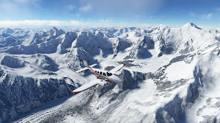
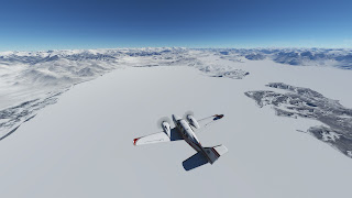
I continue the World Tour by crossing Tajikistan. Right before starting this leg, by chance, I discovered the Orbx Mesh for Middle Asia, which I bought and it's simply amazing. I'm glad I found this right at this leg and not later in the tour, so I'll make a good use of it.
So, for this leg, I plan a trip towards Pamir mountains, the preamble of the Himalaya, with peaks rising over 7,000 m. This won't be an easy leg, since the only airport in that area is very remote, far from any other airfield (the closest being at about 120 nm) and at an altitude of 12,000 ft. Everything is full of mountains, so finding a flat terrain for emergency landing will be tough. Obviously, there are no jobs, nobody wants to go there, except myself. Also, the weather is not that good. Fog at Dushambe and potential clouds during the cruise, but who knows, weather predictions over so tall mountains can fail. I take the risk but prepare a plan B to abort and return to Dushambe if needed.
So I fill the tanks to the top, check all systems and proceed to depart from Dushambe. It has to be IFR, not only because of the fog but also because of airport limitations. Unfortunately, the charts are in km/h, so I have to spend some time converting them to nm. However, the departure was smooth and really beautiful. I begin to notice the benefits of Orbx Mesh as soon as I leave the mist.
After leaving the fog and getting to JD NDB at 9,000 ft. I happily see that the skies are pretty clear in front of me, so I decide to proceed VFR from here. First I head a bit south, to find the Nurek reservoir and, from there, I head north, following Kyzylsu river along a narrow stunning valley containing few scattered villages and mines. I cannot resist to descend to 7,500 ft. to fly between the mountains.
Few miles after Navobod I see some snow, which means problems to track surface features. So from this point I decide to climb to the VFR limit, FL195, and use the Ismoil peak as waypoint, the highest of Tajikistan (7,495 m). This mountain was also the highest of the USSR before Tajikistan became independent in 1995.
Right around Ismoil peak I need to climb up to FL235. It is well over the VFR limit, but considering I'm not higher than 3,000 ft AGL, I guess it's ok. I'll have to use this "trick" along the Himalaya several times anyway. It took me a bit to get used to fly over the critical altitude of the Baron, but everything went fine and I could quickly head towards Karakul and descend to FL195 again.
Karakul lake is a crater impact of 52 km of diameter, very recently in geological terms. I took some time to fly around, both to see its magnitude and to orient myself. The last part of the leg will be tricky, since the reference points are not quite obvious. In addition to this, there is not any kind of radionavigation that could be used here, just visual guiding. I followed some valleys and tall peaks, till reaching Murgab airfield.
Now the landing. I'm at FL195 and the strip is at 12,000 ft. Of course, no METAR or ATIS. So I decided to descend full manual and approach the strip from the east, since the terrain was quite hilly on the west. My idea was to check the winds while flying over, but I had good feelings while approaching. The plane was very stable. Once I was over the runway I saw the windsock showing strong headwind, no crosswind, which was perfect. So I decided to land at the first try.
However, I didn't like something that happened. At the moment in which I was rising the nose to land on my rear wheels, the nose didn't rise. I pulled the yoke to the extreme but again the nose did not rise. It was similar to a stall, but I was not in stall. I suspect it has to do with the density of the air at that altitude. I felt the plane smoother than usual during the manual descent, so I guess that precision maneuvers at that height might take more time. Luckily I was close to ground and everything ended in a hard touchdown.
And this is the highest field I've ever landed at, being 11,987 ft. high. I learnt a lot from this trip, which has been one of the most challenging ones so far. Now, I have to plan the next legs towards Karakoram.
------
JD VFR OBIGARM NOVOBOD HOIT ISMAIL KARAKUL DVUKHGLAVYI
UTDD 231000Z VRB02MPS 5000 HZ FEW066 38/12 Q1009 R09/D TEMPO 28008G13MPS RMK QFE689/0919
N/A


No comments:
Post a Comment