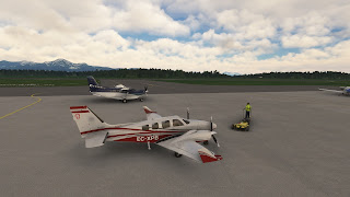
The moment is here. The weather is not the best, but we wanted a challenge, so let's do it. I plan to cross the Kuril Islands on a single leg, with one stop for refueling at the last decent airport before the solitude of isolated volcanic islands. I also plan carefully an alterative asphalt airport at 150 nm from my destination, a tricky dirt strip (covered by snow, I guess). So I need to plan fuel for those extra 150 nm. If something goes wrong on the landing, I might be stuck at a remote village in Kamchatka for weeks.
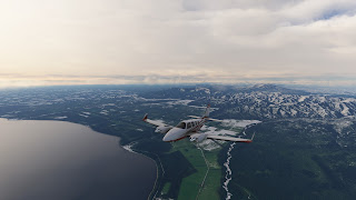
I take off, alone, from Nakashibetsu. Since the leg will be long, I don't mind spending few minutes flying over lakes Mashu and Kussharo, that I skipped on the previous leg. I use this detour not only to check these beautiful caldera lakes, but also to get a good feeling of the ariplane before leaving civilization.
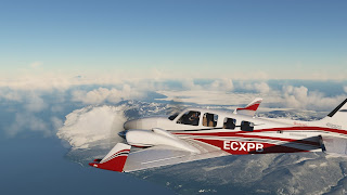
Clouds ceiling doesn't seem to be an issue, since I could reach 9,500 ft without entering on them. However, icing is really bad, getting it even out of clouds. But everything seems nominal, so I decided to leave Japan towards Russia, another new country on this Tour.
The Kuril islands closest to Japan were occupied by the USSR at the WWII and have been disputed by Japan since then. In general, these islands extend about 1300 km and are formed by 56 islands and other minor islets. Their origin is volcanic, to the point that they are literally the top of volcanoes that generated by the subduction of the Pacific Plate under the Oshotsk Plate. Out of the total of 100 volcanoes, 40 are still active, causing strong earthquakes and tsunamis that reach Japan and California. Climate is obviously quite extreme too. However, there are some villages where people substain mainly by fishing and exploiting mineral deposits.
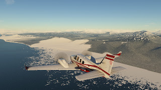
From here, scattered clouds, sometimes dense, sometimes disperse, and cold, about -20 ºC. I flew along Kunashir and Iturup till a concrete strip on this island, in which I decided to land for refueling after seeing the fuel consumption for the first hour. I was flying at 7,500 ft, to enjoy the landscape, not too high, so despiste going LOP, I was not sure of having enough fuel to arrive not to my destination, but to the alternative.
This could have been a leg by itself, but the weather is very dynamic in this region, so based on the predictions, I prefer to stick to the original plan and, after 20 minutes, take off again, towards Urup, the last large island. In any case, from here there won't be any airport suitable for the Baron in 530 nm, with the exception of an isolated grass strip, at the base of a volcano, that doesn't have any kind of services. Only useful, in my case, in the event of an emergency.
Clouds begin to be a problem. And temperature, with already -30 ºC. In addition, crosswinds are strong, at about 30 kt I'd say, so I'm pushed constantly towards the East. I decided to stay at 9,500 ft as long as I'm able to see the islands, but ready to climb and turn around in case I get lost, something that could happen easily with so dense clouds and strong crosswinds altering my heading. From here I flew over a bunch of small islands, very impressive for being basically the tip of volcanoes and calderas.
At about 200 nm to destination, things got worse. Crosswind reached 40 kt and temperature -40 ºC. And turbulences were very strong. The AP barely could keep up with them. By far, the strongest turbulences I've had till now. Plus, suddenly, I lost both RPM and fuel flow indicator of left engine. Initially, with all the chaos and the moving in the cockpit, I thought I had lost the entire engine, so I cut throttle to try to re-start it. However, as soon as I did that, I felt a huge loss of power. I quickly push the throttle forward and recovered the power. So, after thinking for a couple of seconds, I realize the problem was with the instruments, not the engine itself. Indeed, I found the fuse of those instruments out. So well, at least, I have the second engine to monitor the RPMs, and fuel tank indicators to check that everything is symetric. Anyway, minor failure compared to flying the rest of the leg with a single engine, that on these turbulences would have been a huge pain.
I tried to keep the same altitude but the wind was really strong. I descended to 7,500 ft to see if the layers there were more optimal, but same situation. And I didn't want to descend more. Over such a dangerous sea, if I have another failure, I might not have time to find ground... So I decided to pressurize the cockpit and climb till I find a more stable layer. And that happened at FL135, altitude at which the turbulences were not that strong, so less stressful for the airframe. Icing conditions were hard anyway, so I constantly kept an eye on that.
I finally saw the last island, in which there is a village called Severo-Kurilsk with a very suboptimal strip, but at least there's some civilization down there, so in case of a problem, I can land and meet some people with resources. In any case, it was not needed, since the flight went fine from here, flying over the last volcano of the Kuril islands, named Alaid, and heading towards my destination at Kamchatka.
The descent, approach and landing must be done carefully. After 4 hours of travel, it's difficult to focus and easy to make a mistake in such harsh conditions. I initiated a long descent, at a comfortable -800 fpm ratio, avoiding the yellow zone in case of turbulence. The snow on the coast made evident that the dirt strip would be covered by snow and ice, so I wanted to approach slower than usual. In addition, the strip is located in a kind of valley that looks like the shape left by an ancient glacier. So there's not much space for maneuvering. Moreover, no ATIS, no windshock, not a single sign of speed and direction of the wind. The good thing was the length of the strip, far longer of what I need for the Baron. So in case of issues, I have plenty of time to calculate and react. I decided to try to land heading West, since for the whole flight the winds came from that direction. And I managed to slow down and manually do the traffic pattern and land safely.
And... where's the people? There's nothing! I mean, there are houses, beautiful wooden houses typical of these latitudes... but no "terminal" or anything similar... And with the snow I don't see any taxiway or parking spot. This is Russia... I just leave the plane next to a house and will try to find somebody in the streets. Let's see if I can walk after 4 hours of tense flight.
------
SHIBETSU KUNASHIR ITURUP UHSI URUP MILNE PREVO URATAMAN PALLASA HOROCHACHA SARYCHEV RAIKOKE SINARKA OZERO KARPINSKY FUSS SEVERO-KURILSK ALAID KOSHELEV OZERNOVSKII
RJCN 300900Z 02005KT 330V050 9999 -SHSN FEW010 SCT050 BKN/// M04/M08 Q1019
N/A


No comments:
Post a Comment